Low Cost Amateur Aerial Pictures with Balloon and Digital Camera - Example: Aerial Orthophoto Production in Kampong Speu Town Centre, Cambodia

files/images_static/practitioner.jpg

The Department of Land Management and the Department of Urban Planning in Kampong Speu Province in Cambodia was in need for an actual aerial photo for their urban land use planning project. The available black and white aerial photos from 1992 were too old for planning in a fast developing urban area. Mr Teng Peng Seang from “Phnom Penh Geoinformatics Education Center” developed a technique to take aerial photos by using a balloon. Ded (German Development Service) provided the budget to test this technique for the use in urban planning activities in Cambodia. The result was an georeferenced aerialphoto with a resolution of 0,5 m. On the coloured photo, land use patterns were easy to identify; small huts, single trees, walls and fences were clearly visible.

Step 1: Preparation of the Balloon

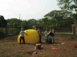
The filling up of the balloon with Hydrogene Gas in the garden of the Provincial Department of Land Management Kompong Speu.


Photo 1: Inflating the balloon takes about 3 hours
files/images/81photo3.jpg

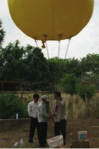
Photo 2: 6 control strings hold the balloon in position
files/images/81photo4.jpg

The filling procedure needed at least three hours. Then the balloon is ready to start.

Step 2: Testing the Wind Speed and Direction

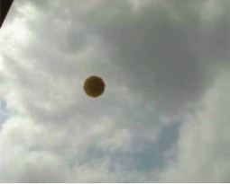
To verify the direction of the wind, a first test start has had been necessary, without the camera equipment. The balloon is controled with three ropes of 1500m length each.

Photo 3: The wind direction above is important to plan the survey
files/images/81photo5.jpg

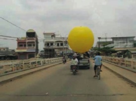
Photo 4: Transport of the Balloon through Kampong Speu Town
files/images/81photo6.jpg


The wind direction in 1000m height is not necessarily the same as on the ground. In this case the verified wind direction made a change of the first launch location necessary to ensure the overlight of the project area.


files/images_static/bulp.jpg

Photo 5: Briefing before the survey

files/images/81photo7.jpg

Photo 6: Camera is remote controlled by a mobile phone

files/images/81photo8.jpg

Step 3: Mount the Camera

The first launch location is fixed, the camera equipment has to be prepared now. Several overflights from different launch locations are necessary to ensure sufficient overlap of the photos and therewith a good quality of the final product.

A digital camera is the core piece of the photographic equipment, two mobile phones are used as transmitter and receiver. In the moment the technique is only possible to apply in areas with mobile phone coverage.


However, in many cases a simplified description of the step-by-step process is always possible.


Step 4: Taking of images using the mobile phone as a remote control

The balloon is launched the balloon with the camera equipment. The equipment is fixed around 10m below the balloon.The balloon will rise to a height of 1000 m to take vertical air photos. The first aerial photo has been taken by calling the mobile that is releasing the camera. While the balloon is slowly flying across the project area, a large number of photos has to be taken to produce later on one final aerial photo.

files/images_static/finger.jpg

Step 5: Measuring Reference Points

A number of GPS points have been taken to verify the location on the ground as exactly as possible. Afterwards the aerial photo has been georeferenced to be ready for use in GIS mapping. The orthophots have been reoreferences to known landmarks on topographic maps.

Step 6: Postprocessing, Mosaicing and Mapping

Once every single orthophoto is geo-referenced, all photos can be merged into one entire orthophoto. This can be used as a backdrop image for vectorising all relevant unit such as roads, water bodies, housing areas, agricultural areas, forest, administrative areas etc.

files/images_static/result.jpg

Photo 9: After georeferencing, mosaicing and post processing, all photos will be merged to a large, high resolution orthophoto

files/images/81photo9.jpg
Finally the Department of Land Management produced a map based on the aerial photo, in order to discuss plans for the future development of the town.


Figure 1: A Municipal Town Plan of Kampong Speu based on Orthophotos

files/images/81figure5.gif