Identification of Desertification Prone Areas - Brief Description
|
|
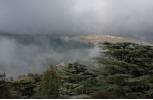
Success in combating desertification will require an improved understanding of its causes and impacts and especially the linkages between desertification and climate, soils, water, land cover and socio-economic factors. Desertification is a condition of human-induced land degradation that occurs in arid, semi-arid and dry-sub humid regions (precipitation/ potential evapotranspiration or P/ETP 0.05 to 0.65) and leads to a persistent decline in economic productivity of useful biota related to a land use or production system. Climatic variations intensify the decline in productivity while restorative management mitigates it. Therefore, the following definition has been adopted by the United Nations Convention to Combat Desertification (UNCCD): "Desertification" means land degradation in arid, semi-arid and dry sub-humid areas resulting from various factors, including climatic variations and human activities. The following method provides a practical approach for defining desertification prone areas in a region, country or area. The method combines the use of existing data and information which is then presented spatially in form of thematic maps. By overlapping these thematic maps the desertification prone areas can be easily deduced. Photo 1: Protected Forested area
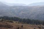
Photo 2: Forested area with signs of degradation
Photo 3: Area being rehabilitated
Photo 4: Degraded areas
|


