Spatial Diagram - Räumliches Leitbild - Principles and General Procedures
|
|
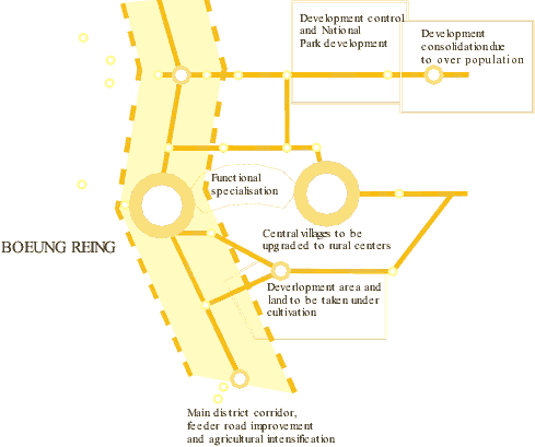
Using pre-printed maps, the information derived from previous analytical steps is gradually transferred on to the maps and presented for discussions amongst decision makers. Since the level of precision in terms of mapping standards is not strictly necessary for the spatial diagram, the zones of influence of the various proposed measures can be delineated in very broad terms. Greater level of precision of the information can be derived in the other analytical steps. Map 1: Example of spatial diagram
|
|
|
In many cases you have to remember that the method itself may be quite complicated and it may not always be so easy to reduce a 3-year university course onto 8-10 pages. |
 |
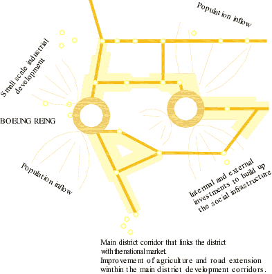
Map 2: Example of spatial diagram indicating spatial concentration in a district or region
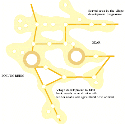
Map 3: Example of spatial diagram indicating spatial dispersion within the district or region
|