Choosing between alternative plans: An assessment approach - Example: Site Selection for a New Railway Station
 |
The Railway Authority, in close cooperation with several departments in the area proposed three different sites for a new railway station. Faced with the task of selecting one of the alternatives, the Regional Planning Unit was requested to develop and apply an objective selection process and then to present the results to the political arena. Short description of the three proposed locations: Location A:
Location B:
Location C:
|
||||||
 |
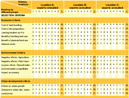
Selection Criteria: Criteria Group 1: Economic criteria
|
||||||
|
|
Criteria Group 2: Environmental criteria:
|
||||||
|
Criteria Group 3: Urban development criteria:
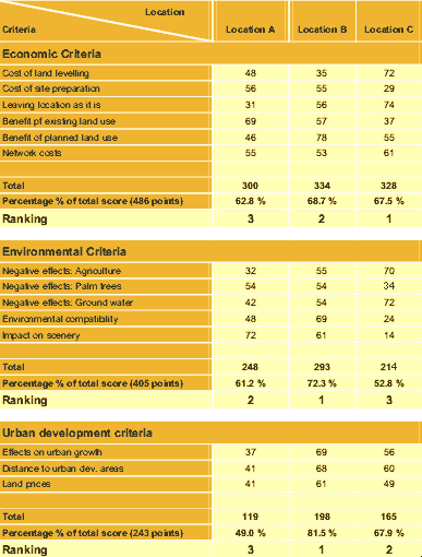
Table 1: Application of selection criteria for different railway station locations
Table 2: Summary of results of selection process
|
|||||||
 |
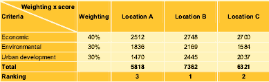
Interpretation of results Weighting and final score
To calculate the final score the percentage figure of the total score per criteria is multiplied by the weighted factor e.g. economic criteria for location A (62.8%) is multiplied by the factor 40 resulting in 2512 points (62.8*40 = 2512). Even after applying the weighting system location B still remains the best choice. This location was then presented as the optimal location to the decision makers. Table 3: Final weighted score
|